Angle of Repose, 2016

by Adam Jarvi

Digital Print

The Angle of Repose is the steepest angle at which a sloping surface formed of loose material is stable. This physics lesson can be seen in real-time across the Iron Range. If you look closely, the loose rock just pushed over the edge can be seen tumbling down the slope.

Price: $150 - $250


Avalanche, 2016

by Adam Jarvi

Digital Print

In Avalanche, a production truck at Hibbing Taconite is captured in the act of dumping a load of waste rock over the edge of an embankment. In the foreground, a stand of birch trees clings to the edge of the snow-covered cliff, several hundred feet above the pit floor. The crimson slope, free of snow cover, illustrates how rapidly mining topography changes.

Price: $150-$500


blast pattern, 2016

by Adam Jarvi

Digital Print

In order to extract the hard rock used at modern day mining operations on the Iron Range, mining companies will drill a large Blast Pattern of holes roughly 1 foot in diameter and approximately 40 feet in depth. The holes are each filled with up to 1,400lbs of explosives. The resulting blasts regularly register as seismic events and occur, like clockwork, once a week when the mine is operating. Because mining activity has expanded in recent years, blasts occasionally result in temporary closures of the region’s highways to prevent injury or damage from airborne debris.

Price: $125-$225


day shift down below, 2016

by Adam Jarvi

Digital Print

Like the other photos in this collection, Day Shift Down Below not only captures the often-disorienting scale of the industrial landscape, but also seeks to emphasize the uniquely temporary nature of it. Here, a production truck the size of a two-story house is seen traveling en route to a nearby shovel. This process occurs around the clock, 365 days out of the year, creating geologically scaled landscape change on an almost unbelievable timeline.

Price: $150-$250


Holding On, 2016

by Adam Jarvi

Digital Print

This weathered and gnarled birch tree, clinging to the edge of a cliff some 600 feet above the floor of Hibbing Taconite’s active mine pit, is in many ways symbolic of the region. The resilience of the tree seen in Holding On…, like the resilience of those who call this place home, is remarkable. Its days are clearly numbered, yet it refuses to give way even as the very earth that supports it slowly disappears.

Price: $150-$250


hull’s rust, 2016

by Adam Jarvi

Digital Print

Rust colored water collects at the bottom of the Hull-Rust-Mahoning pit in Hibbing. The area shown in this photo is now nearly 100 feet deeper, and the vantage point this image was taken from no longer exists.

Price: $150-$250


One Last Look, 2016

by Adam Jarvi

Digital Print

One Last Look offers the quintessential, though ever-changing, view from the observation area at the Hull-Rust-Mahoning Mine View in north Hibbing. This photo was taken just months before the popular overlook was closed. The site on which it stood is now being mined.

Price: $150-$500


pile driver, 2016

by Adam Jarvi

Digital Print

We tend to think of the earth beneath our feet as having a sense of permanence. In mining country, permanence is a rare quality. Here, a Hibbing Taconite production truck approaches with another massive load of rock to be piled next to the others.

Price: $150-$250


relief, 2016

by Adam Jarvi

Digital Print

Dramatic topography is typically the result of geologic forces that occurred in the distant past. The landscape of Minnesota’s Mesabi Iron Range is one of the few places between the coasts where one can find localized elevation changes of the magnitude seen here…and it is all man-made. It is also constantly changing, so much so that the U.S. Geological Survey (USGS) does not even attempt to show this landscape on topographical maps. Areas of mining activity in Minnesota – like the nearly 1,000 feet of relief seen here – are simply left as blank spots on USGS maps.

Price: $150-$250


Slippery Slope, 2016

by Adam Jarvi

Digital Print

A 240-ton production truck begins its slow climb out of the pit. Runoff from rain – and from watering trucks that regularly spray haul roads to limit dust – is tinted shades of brown, red, and orange due to the high iron content of the surrounding rock.

Price: $150-$250


the power of place, 2016

by Adam Jarvi

Digital Print

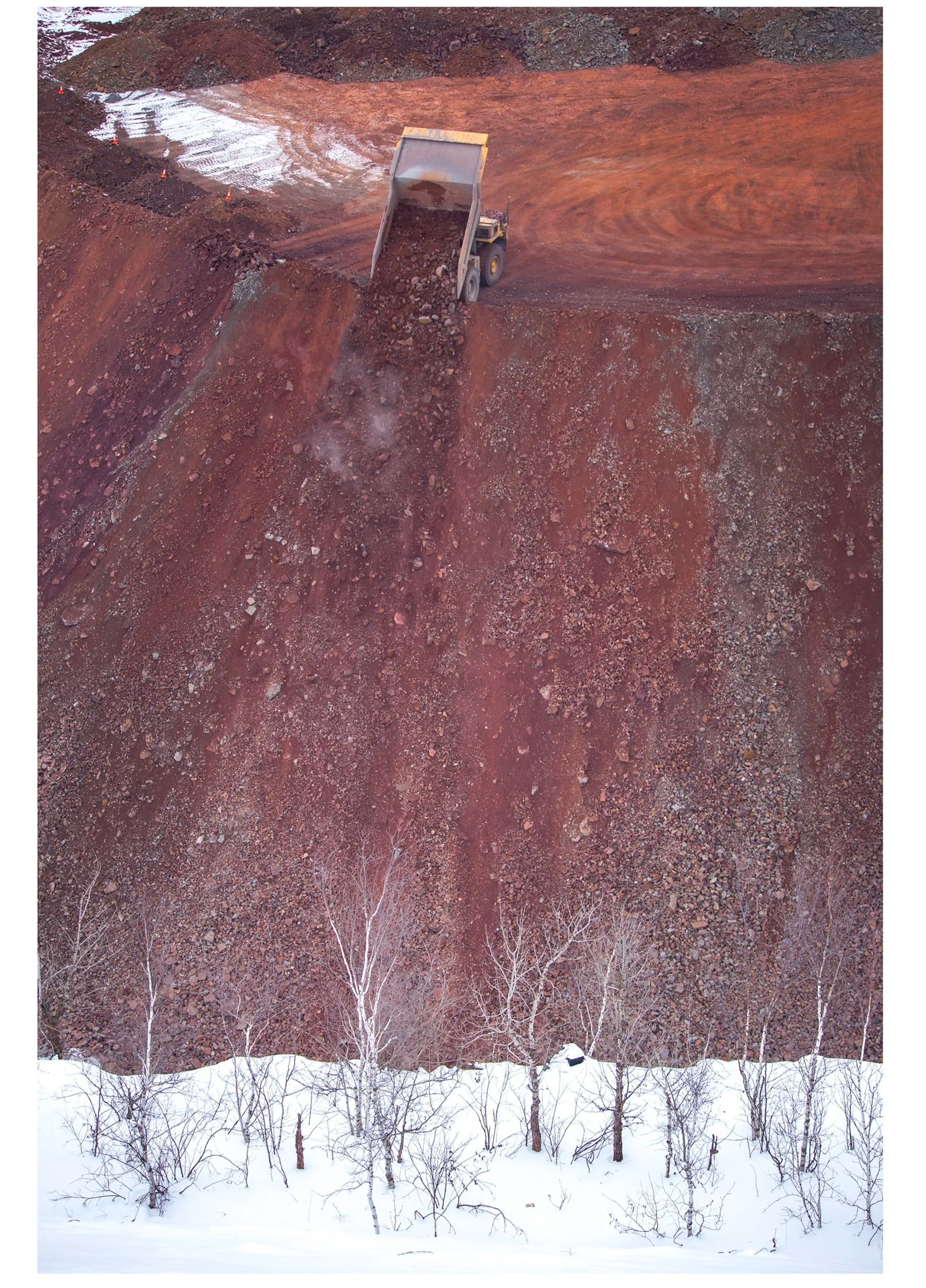
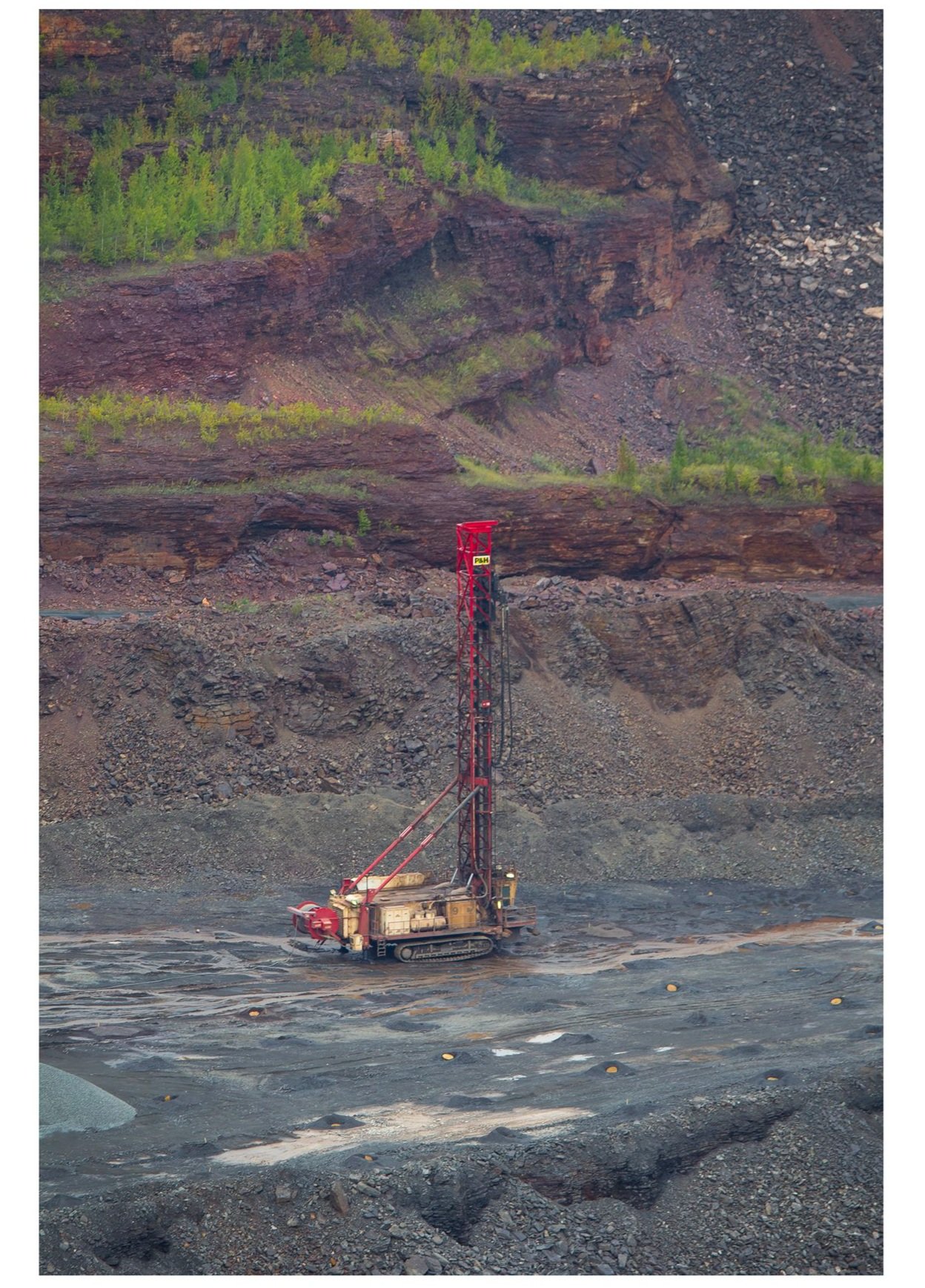
In a region of the country not associated with dramatic topography, the man-made canyons of the Iron Range have come to define this corner of northern Minnesota. It is a landscape that it is constantly changing due to both the booms and busts of an entire industry. We most obviously associate these pits with active mining, yet they also transform once mining stops. After the high-grade ore was depleted in the post-WWII years, many pits were allowed to fill with water. With no natural outlet, this produced pit lake is several hundred feet deep. At one point, the water seen here in the bottom of the Hull-Rust pit reached the base of the vertical cliff in the upper left corner of the photo. Once Hibbing Taconite has depleted the remaining ore body, pumping will stop, and the water level will rise once again.

Price: $150-$250


veins, 2016

by Adam Jarvi

Digital Print

Veins provides an expansive view of the scale of modern mining. On close inspection, one can identify the various layers of earth and rock that have been mined from this pit over the course of 100+ years of active extraction. From the iron-rich purple and deep red veins of high-grade ore that supplied the bulk of the steel used in both World Wars, to the grey taconite mined today, to the lightly colored overburden that must be removed from the surface to get at the rock, the history of the mine is revealed.

Price: $150-$250